

Nepal Disaster Exposes Early-Warning Gaps Across the Himalayas
news

Nepal Disaster Exposes Early-Warning Gaps Across the Himalayas

By Editorial TeamSep 19, 2026 · 4:49 PM4 min read
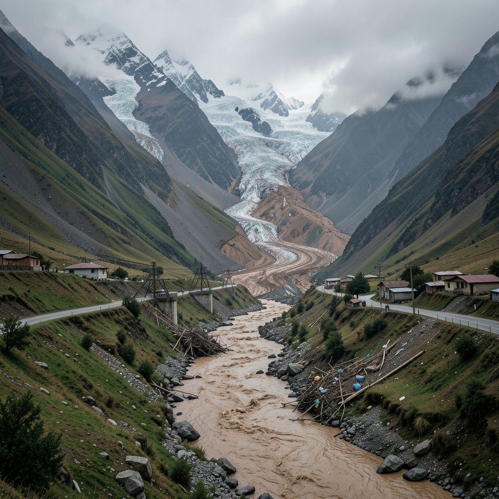
AI-generated representative image: A remote Himalayan valley in Nepal showing a debris flow and damaged infrastructure after a mountain disaster.
Editorial Team
Editorial Team
Cascading glacier floods and avalanches outpace systems built for single predictable threats

An ice and rock avalanche in Nepal's Rasuwa district on August 26 sent a surge of water, mud and debris down the Lhende Khola River that swept away settlements and infrastructure before reaching the Nepal-China border. By mid-September, more than 1,400 people had been reported dead and at least 6,000 remained missing across Nepal and Tibet, while 12 hydropower plants were destroyed.

The disaster has forced scientists and disaster managers to confront a difficult question: how to warn communities when the trigger occurs high in remote mountains, often with only minutes to react.

The scale of destruction underscores a growing regional vulnerability. A warming climate is altering glaciers, snow cover, permafrost and high-altitude lakes even as roads, hydropower projects and settlements push deeper into mountain valleys. This combination creates a risk landscape where one hazard can trigger another, and where conventional early-warning systems built around rainfall or river levels may not provide enough time.

Key Developments in the Disaster

Basanta Raj Adhikari, director of the Centre for Disaster Studies at Tribhuvan University in Kathmandu, described the event as unprecedented in size, affected area and mechanism. He estimated that the energy involved was greater than that released by the Hiroshima atomic bomb, a comparison intended to illustrate the physical forces at play rather than suggest a nuclear equivalence.

Scientists are examining an ice-rock avalanche and other possible processes that temporarily obstructed the river system before releasing a destructive surge. The International Centre for Integrated Mountain Development (ICIMOD) has described the event as an ice avalanche rather than a conventional glacial lake outburst flood, while other researchers have examined the role of local seismic activity.

At least 900 workers were believed to have been inside hydropower tunnels and other facilities in the aftermath. Two workers were eventually pulled alive from a hydropower tunnel nine days after the disaster.

Regional Warning Signs

The warning problem extends beyond Nepal. A study published this year in the Journal of Glaciology mapped 155 glacial lakes above 2,500 metres (8,200ft) across the Himalayas in Indian-administered Kashmir. Researchers found that the area of ice-contact proglacial lakes increased by 26 percent between 1992 and 2024, with five lakes classified as having very high susceptibility to glacial lake outburst floods.

An outburst from those lakes could threaten several thousand buildings, 15 major bridges, roads and a hydropower project. The study also warned that hazards could occur in chains, with an upstream lake outburst potentially triggering secondary events downstream.

Northeast India's Sikkim offers another example. Following the 2023 South Lhonak glacial lake outburst flood that killed dozens and damaged major infrastructure, India expanded monitoring and mitigation efforts. Today, 40 high-risk glacial lakes have been identified in Sikkim, including 16 in the highest-risk category, with authorities working on drainage, flood-retention and other protective measures.

Expert Assessments and Early-Warning Limits

In July, ICIMOD warned that a below-normal monsoon should not be interpreted as a safer one. "The biggest misunderstanding is that less seasonal rainfall means lower flood risk," said Saswata Sanyal, a disaster risk reduction specialist at ICIMOD. "A drier monsoon can still be a dangerous monsoon."

The immediate trigger of the Nepal disaster was not simply heavy rainfall, which matters because a warning system waiting for rainfall or a rising river may not provide enough time when the real trigger happens several kilometres upstream.

Irfan Rashid, a glaciologist and associate professor at the University of Kashmir who co-authored the study, said that without action, the melting, thinning and destabilisation of glaciers, seasonal snow cover and permafrost across the Hindu Kush-Himalayas system would increase, and water shortages could become a major problem across the Upper Indus, Ganga and Brahmaputra basins by the end of the century.

Current Status and Next Steps

Pakistan has begun expanding early-warning infrastructure in the Gilgit-Baltistan region, which contains hundreds of glaciers and glacial lakes. Under a United Nations-supported programme, early-warning systems, evacuation shelters and disaster-management centres have been established in vulnerable valleys.

Disaster scientists increasingly argue that anticipatory action, rather than disaster response, must become the foundation of preparedness. "The era of preparing for a single, predictable hazard is over," Sanyal said. "Anticipatory action and early warning must now be the foundation." A 2026 assessment of Himalayan disaster risks has called for stronger monitoring, early-warning systems and regional coordination across national boundaries.

MORE LIKE THIS

Comments (0)

Leave a comment

A verified Gmail account is required to post comments.

No comments yet. Be the first to share your thoughts!